
St. Louis Delivery Areas
St. Louis City uses delivery ZIPs that orient a searcher to a part of the city, not a set of legal neighborhood lines. The St. Louis ZIP code directory draws those City rows from the Missouri ZIP table, which separates Saint Louis City from Saint Louis and county rows. Area names are practical orientation only. A parcel on an edge still needs an address-level check, especially where a neighborhood, ward, or city boundary turns before the postal route does.
| ZIP | Areas Covered | Post Office | Notes |
|---|---|---|---|
| 63101 | Downtown and the central business district | St. Louis delivery | Station name was not identified in the research. |
| 63102 | Downtown east, riverfront, and near-north core | St. Louis delivery | Verify a specific address. |
| 63103 | Downtown west, Midtown, and Old North-adjacent central blocks | St. Louis delivery | Orientation only. |
| 63104 | Lafayette Square, Soulard-adjacent areas, southwest downtown, and Compton Heights edge | St. Louis delivery | Neighborhood splits need an address check. |
| 63106 | Old North, near north, and JeffVanderLou portions | St. Louis delivery | Not the same as a neighborhood line. |
| 63107 | North St. Louis areas around Fairground and Hyde Park portions | St. Louis delivery | Confirm the parcel and city limit. |
| 63108 | Central West End, Midtown, and nearby central neighborhoods | St. Louis delivery | The inspected Portland Place parcel used this ZIP. |
| 63109 | Southwest city, including Lindenwood Park and St. Louis Hills vicinity | St. Louis delivery | Exact edges vary. |
| 63110 | Forest Park Southeast, Shaw-adjacent, and medical-forest park areas | St. Louis delivery | Exact edges vary. |
| 63111 | Carondelet, Patch, and south river areas | St. Louis delivery | Includes industrial and residential areas. |
| 63112 | Skinker-DeBaliviere, Academy, West End, and north Central West End portions | St. Louis delivery | Check the street and parcel. |
| 63113 | Wells-Goodfellow, Kingsway East, and near north-central areas | St. Louis delivery | Verify the city boundary. |
| 63115 | Kingsway West, Hamilton Heights, and upper north city areas | St. Louis delivery | Verify the city boundary. |
| 63116 | Bevo Mill, Dutchtown, Holly Hills, and Southampton portions | St. Louis delivery | ZIP and neighborhood lines differ. |
| 63117 | City-county edge postal geography | St. Louis delivery | Not every address is inside the City. |
| 63118 | Tower Grove East, Benton Park, Marine Villa, and Gravois Park portions | St. Louis delivery | Exact edges vary. |
| 63120 | Baden, College Hill, and north city portions | St. Louis delivery | Check parcel and boundary. |
| 63139 | Southwest and near southwest areas around Clifton Heights and Franz Park | St. Louis delivery | Neighborhood coverage was not fully located. |
| 63147 | North river, industrial, and adjacent north city areas | St. Louis delivery | Verify the parcel and city boundary. |
The table is a delivery starting point. It does not prove that an address lies inside the independent City, nor does it show who receives mail there. The City Address & Property Search, City Limits layer, and the legal parcel description provide the next checks when an office or record must be selected.
Find a St. Louis ZIP
Finding a ZIP for a known location works best as an address check rather than a name search. USPS standardizes the delivery address, while City systems add the municipal and parcel context. Start with the address as it is written on the record, preserve apartment information when it is known, and compare the result against the City boundary before contacting a City custodian.
- Use the USPS ZIP Lookup in its By Address mode with the street address, city, and state.
- Enter the same address or parcel in the St. Louis City Address & Property Search to read the parcel result and its ZIP context.
- Compare the address with the City GIS ZIP and City Limits layers, then note whether the result is inside the independent City or a county municipality.
- If a ZIP narrows the question to a particular street, use the St. Louis street directory for address-by-address records rather than treating the ZIP as a street roster.
USPS says a ZIP result does not confirm that a person or company is at the address. It is therefore a delivery check, not occupancy evidence. The City property search is address- or parcel-keyed and does not offer a public online owner-name search.
Note: Preserve the exact street number and parcel identifier when a ZIP crosses a municipal edge, because the delivery label alone cannot choose the proper record custodian.
USPS St. Louis ZIP Fields
The inspected USPS tool has three routes: By Address, By City & State, and Cities by ZIP. For a specific St. Louis address, By Address is the useful route because it asks for the delivery components that distinguish one location from another. Keep the returned postal result separate from City parcel, ward, and neighborhood information.
| Field | Type | Required | Format or Use |
|---|---|---|---|
| Company | Text | No | Optional delivery detail. |
| Street Address | Text | Yes | Known street address. |
| Apt, Suite, or Other | Text | No | Optional unit detail. |
| City | Text | Yes | Enter the mailing city. |
| State | Dropdown | Yes | Select Missouri. |
| ZIP | Text | No | Optional when checking a known address. |
| Find | Control | Yes | Returns postal standardization information. |
The City mapping office supplies the local geography that USPS does not attempt to decide. Its boundary service exposes ZIP Codes as layer 5 alongside City Limits, City Blocks, Neighborhoods, and Wards. The service supports JSON, GeoJSON, and PBF query formats, but it is a map service, not a bulk resident export.
St. Louis ZIP Boundaries
St. Louis City is independent from St. Louis County. That legal split changes the assessor, recorder, election authority, and court circuit that may hold a record. A postal address written as “St. Louis, MO” can be geographically accurate while still pointing to a county municipality. ZIP 63117 is the clearest warning in the City list because it is a city-county edge delivery geography and not every address in it belongs to the City.
There are other layers inside the City as well. The GIS service carries ZIP, neighborhood, ward, City Block, and City Limits layers, and those boundaries do not perfectly overlap. St. Louis recognizes 79 official neighborhoods, including Central West End, Soulard, Benton Park, Carondelet, Dutchtown, Bevo, Shaw, and Tower Grove East or South. Those names can help orient a search, but the parcel and City Limits result decide municipal jurisdiction.
Boundary check. A ZIP is a delivery geography. Before requesting a City record, compare the known address with the City Limits layer or City parcel result, not a mailing-city label alone.
St. Louis ZIP Delivery Types
Not every number in the official City ZIP rows describes an ordinary neighborhood route. The table also identifies 63150, 63151, 63155, 63156, 63160, 63163, 63164, 63166, 63167, 63169, 63171, 63177, 63178, 63179, 63180, 63182, 63188, 63195, 63196, 63197, 63198, and 63199 as special, unique, PO-box-style, or institutional delivery codes. The research did not locate the exact facility or post-office assignment for each one.
- ZIP
- In the City records context, a ZIP is a postal delivery geography and is not a parcel, ward, or legal boundary.
- ZIP+4
- The inspected USPS material documented address lookup fields, not a separate St. Louis ZIP+4 record rule. Use the postal result for address standardization, not as proof of occupancy.
- PO-box ZIP
- The official City list includes PO-box-style codes. They should not be treated as ordinary residential neighborhood ZIPs.
- Unique ZIP
- The official table also flags special or unique delivery codes. Exact facility assignments were not located in the reviewed sources.
- Carrier route
- A City public-record search field for carrier route was not located. City property work uses an address or parcel, while the GIS service provides boundary layers.
These distinctions prevent a common error: counting a special delivery code as if it marked a neighborhood. USPS can supply the postal answer for a known address, while the City mapping and parcel systems identify the local government context.
St. Louis ZIP Map Layers
The City Address Validation API is refreshed nightly and can return a standardized address, ZIP, ward, neighborhood, police district, and map coordinates. It requires an API key, so it is a City service for authorized use rather than a public form to automate. City Mapping and Graphics maintains ZIP, ward, neighborhood, zoning, and aerial maps, while the ArcGIS MapServer provides the public layer list.
The City Mapping and Graphics office is the documented local map source for this kind of geographic check.
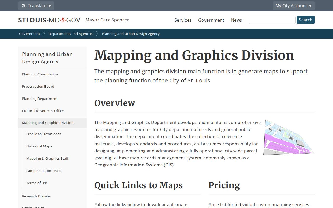
The mapping-office view supports a ZIP check with neighborhood, ward, zoning, and aerial-map context. It does not turn a ZIP layer into a household list, and parcel records remain the better route for a specific property.
For an address inside the City, the property result can show a hyphenated parcel ID, collector account, legal description, neighborhood, ward, precinct, and ZIP. Parcel and collector numbers are joins for City property and recorder work. They are not ZIP codes, even when all of the data appears on one result.
St. Louis ZIP Record Limits
ZIP is not a documented stand-alone filter in the City Address & Property Search. That search accepts a street address or parcel. Missouri Voter Outreach is also not a ZIP-first tool: the public portal requires registered first name, last name, date of birth, last four SSN digits, and county. A voter-file request can include address, city, state, and ZIP output, but the research did not locate a ZIP-only request option.
Missouri law makes selected voter fields public under RSMo 115.157 while protecting sensitive values and Safe at Home residential addresses. A full voter file has noncommercial-use limits, and the City Board of Election Commissioners is the appropriate City contact for a current city request. A registration record is a verification layer, not a complete set of people associated with a ZIP.
Note: Keep voter, mailing, and parcel information in their own columns because each record type has a different address purpose and a different legal limit.
St. Louis ZIP History Checks
Older address research often needs a map and a directory rather than a modern ZIP alone. The St. Louis County Library holdings include city directories beginning in 1821, annual city microfilm from 1864 through 1931, and a documented reverse section in the 1922 volume. A reverse directory starts from an address and can supply a historical occupant or business by year. It is historical evidence, not a current household record.
The Missouri Historical Society address index can search street number and street name without a suffix, and its 12** pattern can return a 1200-series address. Old maps, adjacent addresses, City Block/Lot details, and the legal description help bridge a renumbered or renamed street. The City research did not locate a single citywide renumbering year, so a failed modern ZIP or address lookup should not be treated as proof that an older address never existed.
St. Louis ZIP Access Routes
Use USPS online for postal standardization, then use City Address & Property Search or the City GIS service for an address or parcel inside the City. City Assessor Records & Mapping also provides ownership-transfer, plat, and mapping assistance at City Hall Room 114, by phone at (314) 622-3212. The City mapping office can clarify the local boundary layer when the public map alone is not enough.
For a historical address, the library shelves, microfilm, and local-history staff are the documented fallback. The Missouri Historical Society index can supply street-address references, and City Recorder DirectSearch or the Assessor counter can help interpret a legal description when an old street label does not align with a present delivery address. Those routes keep the St. Louis ZIP code directory focused on geography while leaving property and street records with their proper custodians.